First off, here is a map that shows the route we took from Ouray to Yankee Boy Basin. There isn't enough detail here to show some of the places we saw, or to give a real appreciation for where we were, but it will give you a good geographic idea of where we started and where we ended.
View Larger Map
The next couple of pictures show the road we were on starting our trip. The road was literally cut into the side of the mountain in places like this.
The next few pictures are of an abandoned mine. The first one is one of the buildings that was collapsed, with my brother Tim standing in front. The next two were in front of the entrance to the mine itsself. The last one is actually inside the entrance. I was really hoping to get to go inside, however, the gate was welded. I know some are probably going to think 'Are you NUTS!? going inside a mine is STUPID!!' I just wanted a peek beyond the entrance, nothing beyond that. Just thought it would be cool :D
This is a view back the way we came. We are at Yankee Boy Basin.
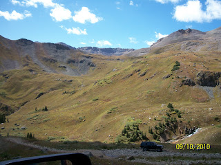
Some pics of the view around the basin.
The next couple of pics are of the signage that is at the trailhead that continues on deeper into the mountains. This is where the jeep trail ends, but certainly not where the adventure ends for those with the time and ability to continue on. We had to hurry back to dump my sister on poor old Scott... I mean watch her get married :)
(yes we were at 12,170' above sea level!)
The following pic I took on the way down. We stopped and crossed the stream to get a closer look at this ruins. It appears from a bit of research on the web that this is the Silver Trust mine. I can't be for sure, as there are several mines in the local area, and unfortunately they aren't well documented. There appears to have been a tram system set up as you can tell from the big wheels that are visible in the upper portion of the ruins. There is also a tower still standing off to the left of the picture (that I didn't get a good shot of) that had some cables that were laying on the ground. Very fascinating ruin.
This last picture is of an apparent foot bridge that crosses the ravine. No idea about the original purpose behind it other than that of the reason a chicken crosses the road. (to get to the other side!)
Next up: The Wedding! Stay tuned....


